Barma-Wanderung
Sportaktivitäten, Laufsportarten, Fußwanderungsstrecke
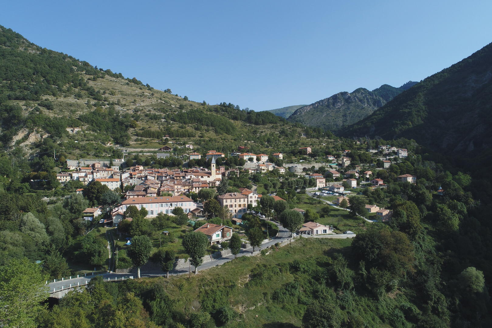
Um Moulinet
7.9
km
-
Eine erfrischende Wanderung durch bewaldetes Gebiet, entlang einer Vielzahl von Bächen. Schaltung
-
Der Start erfolgt vom zentralen Platz des Dorfes aus. Gehen Sie am Ortsausgang auf der RD 2566 in Richtung Sospel in Richtung des Viertels Saint-Sébastien. Überqueren Sie die Roubine-Brücke, die über den Fluss Peira-Cava führt, und biegen Sie kurz darauf links von der Straße in einen breiten, steinigen Weg ein (Markierung 20), der zur Kapelle Saint-Sébastien führt. Nehmen Sie dann links den kleinen Weg und überqueren Sie die Brücke von Mouravi. Sie gelangen nun in die Kernzone des...
Der Start erfolgt vom zentralen Platz des Dorfes aus. Gehen Sie am Ortsausgang auf der RD 2566 in Richtung Sospel in Richtung des Viertels Saint-Sébastien. Überqueren Sie die Roubine-Brücke, die über den Fluss Peira-Cava führt, und biegen Sie kurz darauf links von der Straße in einen breiten, steinigen Weg ein (Markierung 20), der zur Kapelle Saint-Sébastien führt. Nehmen Sie dann links den kleinen Weg und überqueren Sie die Brücke von Mouravi. Sie gelangen nun in die Kernzone des Mercantour-Nationalparks. Gehen Sie auf diesem Weg weiter bis zur Markierung 21 und folgen Sie dann rechts in Richtung Sospel. Überqueren Sie die alte, mit Moos und Efeu bewachsene Brücke von La Barma und folgen Sie den gelben Markierungen. Der Weg steigt an und man hat hier bemerkenswerte Aussichtspunkte auf den Mont Simon, das Dorf Moulinet und die Stätte der Kapelle Notre-Dame de la Menour. Ein guter Vorwand für eine kleine Pause!
Gehen Sie dann auf dem Kamm durch Buchsbaum, Thymian, Lavendel und Ginster bis zur Markierung 24 weiter. Biegen Sie hinter einer kleinen Anhöhe nach links in Richtung Avanquet ab. Auf diesem neuen Hang (Vallon de la Bouissièra) ist das Unterholz sehr angenehm, vor Ihnen die Kämme von Déa, Tuèis, Turini und Calmette. Gehen Sie weiter, bis Sie die Abzweigung erreichen, die durch einen quer über den Weg liegenden Baum markiert ist, auf dem die Richtung Moulinet (links unterhalb) eingemeißelt ist. Gleich danach überqueren Sie den Wildbach, um auf den Weg auf der anderen Seite des Ufers zu gelangen.
Nach einigen hundert Metern steigen Sie links inmitten der Ruinen von Avenquet zwischen 2 eingestürzten Steinmauern hinab. Überqueren Sie die Gouargas-Brücke und gehen Sie am Fluss entlang, bis Sie in die Nähe einer alten Eiche und eines Wohnhauses kommen. Gehen Sie links vom Haus weiter bergab, bis Sie die Markierung 21 und den ursprünglichen Weg nach Moulinet erreichen.
- Abfahrt
- Moulinet
-
- Ganzjährig.
-
-
Umwelt
-
-
-
Gesprochene Sprachen
-
-
-
-
-
Dokumentation
- Mit GPX / KML-Dateien können Sie die Route Ihrer Wanderung zu Ihrem GPS (oder einem anderen Navigationswerkzeug) exportieren
-
- Alle Kommentare ansehen