

Wanderung Tende - La Brigue über den Col de Lubaïra
Sportaktivitäten, Laufsportarten, Fußwanderungsstrecke
Um Tende
2Uhr
Leicht
-
Entdecken Sie zwei typische Dörfer im Rhythmus Ihrer Schritte...
-
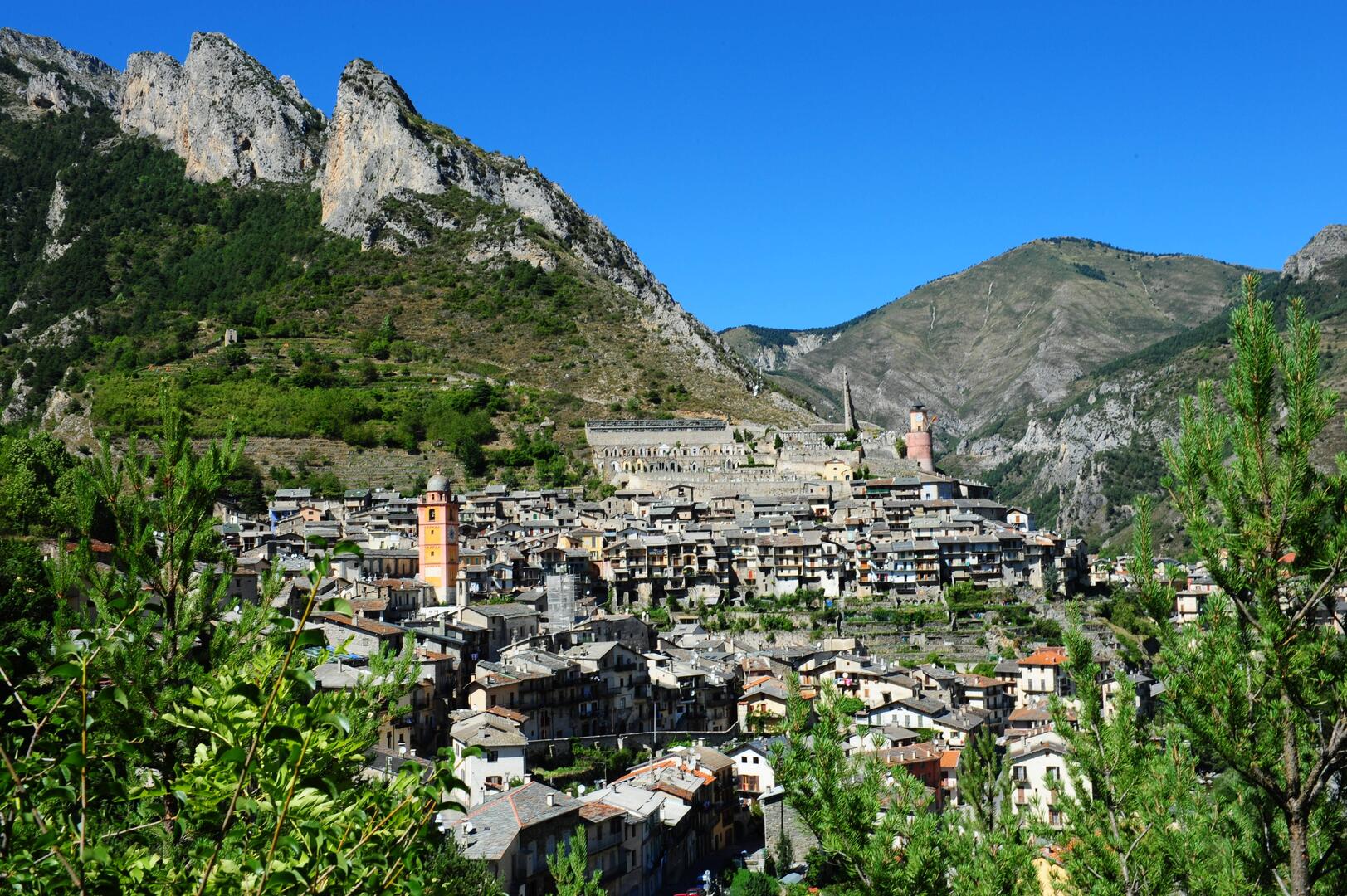
- Durchqueren Sie das alte Dorf Tende auf der Rue de France und dann auf der Rue Cotta. Die Markierung 53 markiert den Ausgang des Dorfes, weiter auf der schmalen Straße.
- Nach 15 Minuten nehmen Sie die Fußgängerbrücke auf der linken Seite und überqueren die Straße. Gegenüber nehmen Sie rechts die kleine Straße in Richtung "Col de Lubaïra" (Markierung 52), die zu einem Waldweg wird.
- Nach einigen Serpentinen erreichen Sie die Markierung 51, an der ein Pfahl steht, der den "Col de Loubaira"...- Durchqueren Sie das alte Dorf Tende auf der Rue de France und dann auf der Rue Cotta. Die Markierung 53 markiert den Ausgang des Dorfes, weiter auf der schmalen Straße.
- Nach 15 Minuten nehmen Sie die Fußgängerbrücke auf der linken Seite und überqueren die Straße. Gegenüber nehmen Sie rechts die kleine Straße in Richtung "Col de Lubaïra" (Markierung 52), die zu einem Waldweg wird.
- Nach einigen Serpentinen erreichen Sie die Markierung 51, an der ein Pfahl steht, der den "Col de Loubaira" und seine Höhe (997) angibt. Sie folgen dem Weg in Richtung La Brigue und dem Klettergebiet. Sie kommen an der Markierung 45 an. Wenn Sie links auf die Hauptstraße des Dorfes abbiegen, erreichen Sie das Zentrum des Dorfes. Wenn Sie rechts abbiegen, erreichen Sie den Bahnhof in 5 Minuten.
Um die Wanderung zu verlängern, warum nicht bis nach Saint-Dalmas de Tende (siehe Circuit des 3 villages) oder nach Notre-Dame des Fontaines (siehe Sentier d'interprétation vers Notre-Dame des Fontaines) gehen.
- Abfahrt
- Tende
-
-
Ganzjährig.
Nur bei günstigen Schneeverhältnissen.
-
-
Gesprochene Sprachen
-
-
-
-
-
-
-
Dokumentation
- Mit GPX / KML-Dateien können Sie die Route Ihrer Wanderung zu Ihrem GPS (oder einem anderen Navigationswerkzeug) exportieren
-
- Alle Kommentare ansehen
Service
-
-
Dienstleistungen
-

")